Streaming service×ジェノバ - List of Manufacturers, Suppliers, Companies and Products

Streaming service Product List

1~2 item / All 2 items

Displayed results

High-precision, high-quality network RTK distribution service

Galileo data distribution has started! A higher fix rate enables stable high-precision positioning, achieving improved productivity!

Our company provides a service that receives and analyzes real-time data from electronic reference points released by the Geospatial Information Authority of Japan, delivering high-precision positioning correction data. We have also started distributing satellite data from the EU's satellite positioning system "Galileo." By adding "Galileo" (with 3 to 7 satellites over Japan) to the conventional GPS+GLONASS+QZS, we can ensure the necessary number of satellites and DOP for RTK positioning even in environments with many obstacles, significantly improving the Fix rate. ◆ Feature 1: DOP is secured 1. A low degradation factor continues. 2. A good satellite configuration lasts longer. 3. Data stabilizes. ⇒ Can be used with confidence! ◆ Feature 2: Fix rate increases 1. The duration of Fix increases. 2. Good accuracy can be received for a longer time. ⇒ Can be used with confidence! *For more details, please refer to the PDF document or feel free to contact us.

  • others

Added to bookmarks

Bookmarks list

Bookmark has been removed

Bookmarks list

You can't add any more bookmarks

By registering as a member, you can increase the number of bookmarks you can save and organize them with labels.

Free membership registration

PPK, leave the post-processing analysis to us! Genova's post-processing data distribution service.

Distributing reference station data (RINEX data) used for PPK and post-processing analysis in GNSS positioning! Utilized in MMS, aerial surveying, and drone surveying.

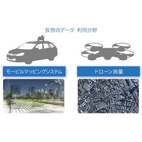
Satellite positioning can be performed independently without using network communication, and by analyzing the observed data along with reference station data (RINEX data) using post-processing analysis software, high-precision location information can be obtained. Regarding reference station data, there is no need for the physical installation of reference stations; it can be obtained through a method that virtually generates data at specified coordinates (virtual points) or by downloading it from designated electronic reference points provided by the Geospatial Information Authority of Japan. ■ A video explaining "virtual point data" in an easy-to-understand manner is available here: https://www.jenoba.jp/movie3.html 【Main Use Cases】 - Public surveying, land and property surveys - Surveys (measurements) and inspections using drones and UAVs - Aerial surveying - Mobile Mapping Systems (MMS) - 3D map creation 【Features of the Distribution Service】 - High-precision positioning is possible without network connection on-site - No need for the installation of reference station facilities - Data from the past six months can be obtained at one-second intervals - "Electronic reference station data" and "virtual point" data are available; by specifying nearby reference station locations for virtual point data, even higher precision positioning can be expected.

  • Surveying Office
  • Other measuring instruments
  • Other civil engineering works

Added to bookmarks

Bookmarks list

Bookmark has been removed

Bookmarks list

You can't add any more bookmarks

By registering as a member, you can increase the number of bookmarks you can save and organize them with labels.

Free membership registration